ENG-ITA
THE GOOGLE TRILOGY | Report a Problem • Michele’s Story • The Driver and the Cameras
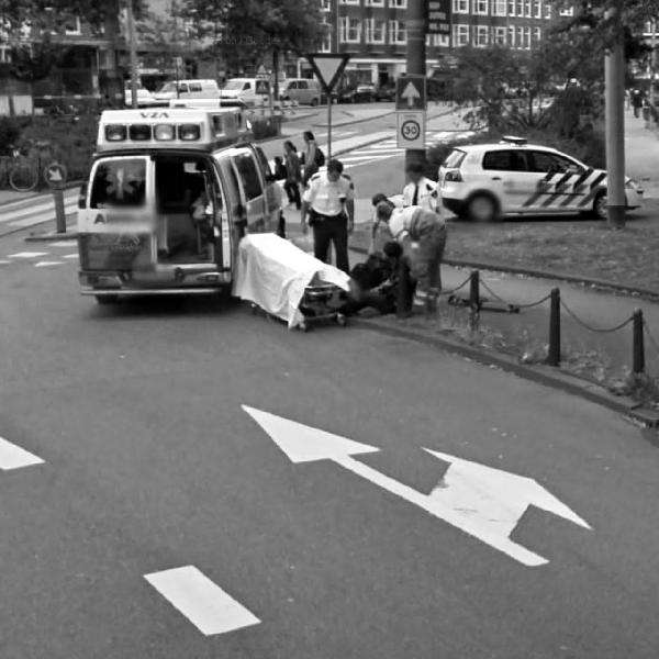
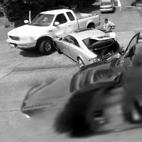
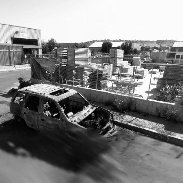
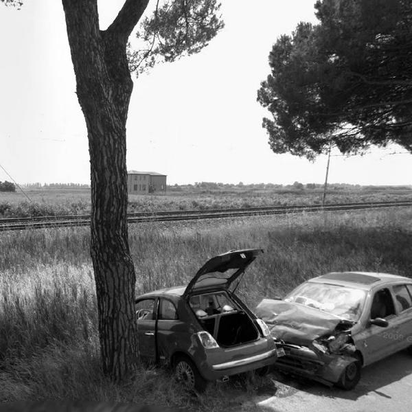
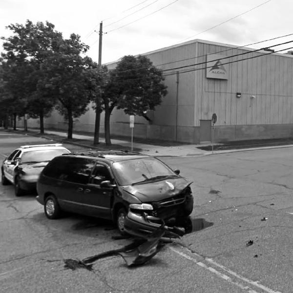
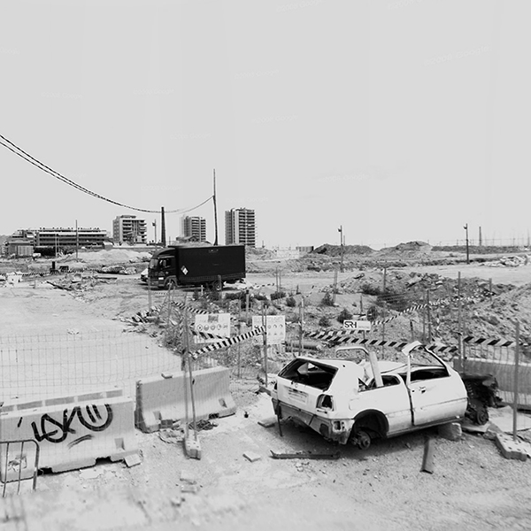
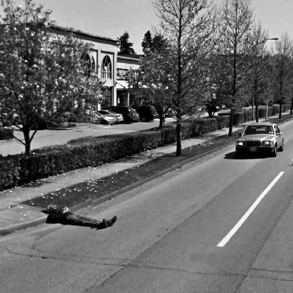
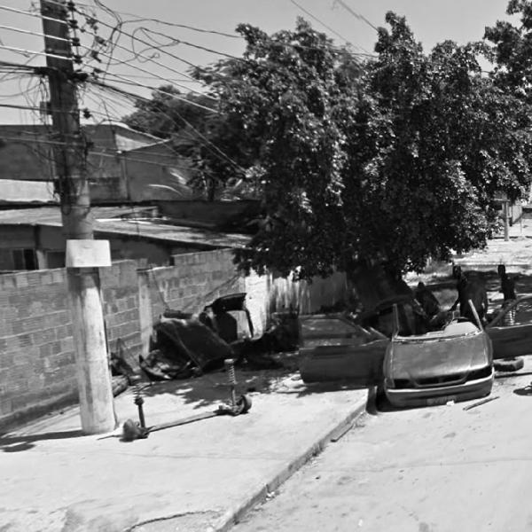
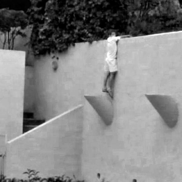
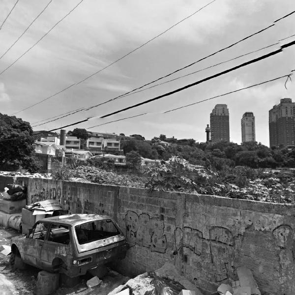
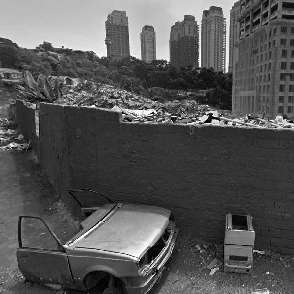
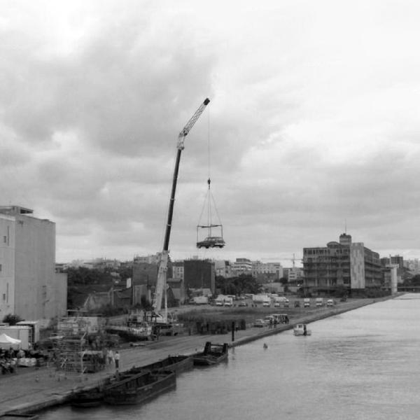
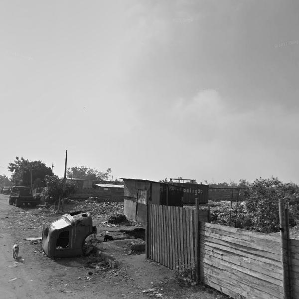
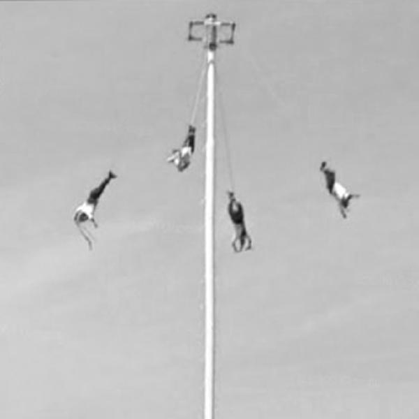
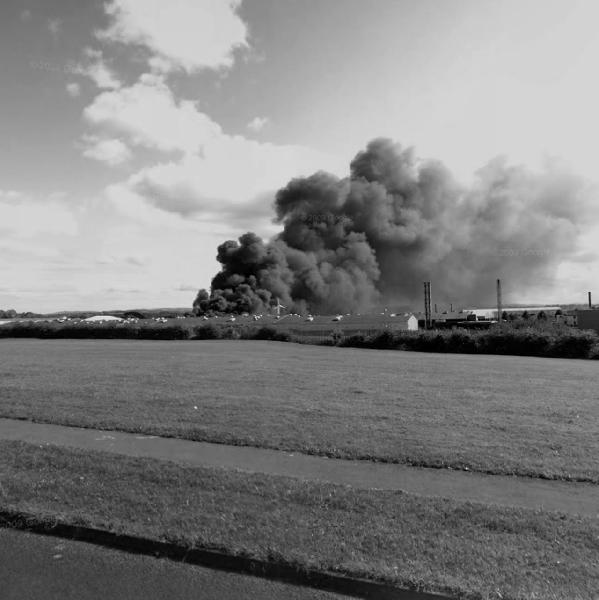
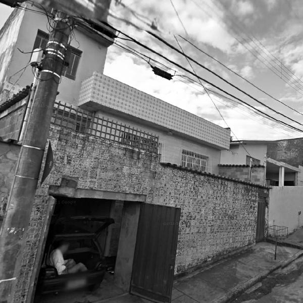
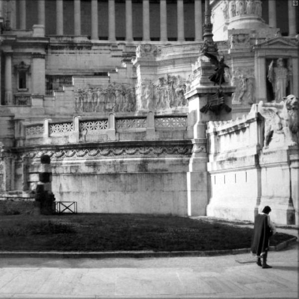
THE GOOGLE TRILOGY – 2.Michele’s Story, 2012. Digital prints on photographic paper. 4 elements. X:620cm; Y:136cm overall
Google Street View offers an immense public archive of panoptic images, the result of a systematic work which mechanically records aspects of life while avoiding human contact with the subjects photographed. I started working with some of these photos with Michele, a man who in 2007, as a result of an accident, became almost completely paralyzed and had memory damage. The collection of 100 photographs, a result of this collaboration, is composed of details taken from Google Street View and attempts to precariously reconstruct a single human journey by recovering snippets of stolen and dehumanized life.
EXHIBITIONS
- MUFOCO – Museo di Fotografia Contemporanea, A Parallel World (2018), curated by Joan Fontcuberta, Triennale di Milano, Italy
- #watch22 (2015), curated by Günter Minas, Bonifazius-Türme, Mainz, Germany
- Luoghi Comuni Festival – Net Art Section (2015), Altamura (BA), Italy
- EMAF 27th European Media Arts Festival, WE. THE ENEMY (2014), Kunsthalle Osnabrueck, Germany
- SLINGSHOT, Festival of Music, Eletronic Art & Technology (2014), Athens GA, US
SOME PERSONAL THOUGHTS ON GOOGLE MAPPING:
A layer of subtle threads connects digital cartographic techniques, map users, and mapping technologies. To each kind of map, corresponds a certain set of ideals, which informs the work of the map makers, and in turn produces specific subjectivities that operate in relation to specific mapping technologies. In other words, by looking at today’s digital mapping, we can discern a set of particular ideologies that guide how maps are imagined, coded, designed and used, and how they operate across physical and virtual realities. More importantly, by looking at digital mapping, we can retrace how particular ideological constructions are mediated and conveyed by specific digital artifacts, and how the interweaving of these conceptual and technical threads informs the fabric of our very subjectivity.
Google’s mapping project is the perfect exemplification: it consists of a layered entity revolving around two main poles: Google Maps, with its emphasis on routing and navigation, and Google Earth, with its emphasis on geo-visual exploration. When considered in its entirety, the assemblage of Google services, platforms, infrastructures, applications and technologies presents the world as a seamlessly searchable, movable and navigable representation. Technical descriptions of how Google mapping is configured (in terms of hardware, software, services and applications) can easily become outdated because of the company’s constant updates. Nevertheless, what began as a series of mapping experiments in 2007 has grown to offer navigable photo-panoramas in 3D and cartographic maps in 2D through Google Maps and Google Street View, 3D navigable aerial and satellite views through Google Earth, along with the celestial representations of Google Sky – ultimately configuring Google mapping as the most used and widespread mapping technology in the world. Google mapping is predicated on ‘curating’ and ‘mobilitating’ content. Its mission is built upon a constant movement, the foundation for any form of mapping and exploration, here defined in the form of the digital movement of its users and their data, and in that of the geopolitical movements of the company itself at a global level.
The end-goal of Google mapping is nothing more than the oldest archetypical obsession of any mapping effort: that of mapping a territory until the map itself becomes a territory in its own right. In a way, it seems as if Google’s users can finally experience the map imagined in 1946 by Argentine writer Jorge Luis Borges in his On Exactitude in Science: a tale in which the Empire orders its cartographers to build a map so detailed that it ends up covering, and swallowing, the entire territory that it ought to represent.
And yet, digital mapping is inseparable from a subject always mediating his/her position and escaping fixity, in a process of spatial and visual mediation that I call media-flânerie. Historically, the word ‘flâneur’ gained cultural prominence in the 19th century, initially referring to people who loved to stroll and wander aimlessly. The flâneur was the first real connoisseur of the modern metropolis, and flânerie, from a cultural perspective, was the product of modern crowds, modern cities like Paris, and mass communication. But does it still make sense to talk of flânerie at a time in which people seem to be more and more confined by their technological devices? And what kind of flânerie is possible when public spaces of aggregation become increasingly rarer and leisure walks have almost disappeared under the freneticism of western lifestyles? As modern cities radically change and become increasingly more networked, the concept of media-flânerie can reflect the specificity of a media saturated environment. For example, whereas flânerie existed in relation to moving through the specific architecture of Paris’ arcades, media-flânerie is instead the product of new digital movements through software architectures, information highways, data aggregates, and hybrid interfaces. To each new set of movements and to each new kind of environment correspond new possibilities of media-flânerie. The media-flâneur, then, is the subject emerging from this particular intertwining of the politic with the poetic across new technologies of order and control, such as digital mapping, and through novel creative subversions of those very technologies. The suffix ‘media-’ stands for the important role played by multimedia technologies, but also, and more importantly, for issues of ‘mediation’ between predefined outputs and alternative goals that are at the core of creative exploitations of errors and glitches.
The flâneur, as it was first described by French poet Charles Baudelaire, and was later rethought by German philosopher Walter Benjamin, is also the subject who more than any other has represented and embodied scopic movement, eventually becoming the archetype of the modern observer. Today, what we consider the realm of visuality is constantly processed and dislocated via media technologies within an environment understood in itself as media-process. Can we still think of the Benjaminian flâneur as the subject at the center of such a media-environment? Today’s flâneur is concerned with urban spaces just as much as it is concerned with constant streams of images offered by all kinds of unified interfaces, digital tools and ubiquitous screens – with his or her movements constantly shifting between physical and virtual places. The media-flâneur operates in the interstices between data collection, social media presence, and 24/7 surveillance, where almost everything is always ready to be quantified and assembled into some kind of big-data pool. The media-flâneur spans mass participation, swarming, hyper-connectivity, collective intelligence, alienation, disjunction, paranoia and individualism – often in quick succession. Yet, the media-flâneur is also characterized by an appreciation of gaps, errors, ruptures and instabilities, as if he/she could find in them a way of escaping the capturing devices of media-capitalistic assemblages in which he/she is always already participating.
THE GOOGLE TRILOGY sits precisely within this fragmented landscape of images, maps, media processes, and cultural reconfigurations – presenting, representing and expanding the concept of a media-flânerie in constant becoming.
(SELECTED) BIBLIOGRAPHY

[INTERVIEW]
Doppiozero
“Glitch: la verità nell’errore. Conversazione con Emilio Vavarella”
Interview by Mauro Zanchi and Sara Benaglia, 5 July 2020. (ita)

[INTERVIEW]
Juliet
“Emilio Vavarella – Interdisciplinarità artistica”
Interview by Emanuela Zanon, Magazine n. 192, apr/mag 2019. (ita)

[BOOK]
Behind the Smart World: Saving, Deleting and Resurfacing Data
Vavarella, Emilio. “THE GOOGLE TRILOGY: Or How To Play With Google Street View”
Book edited by Linda Kronman and Andreas Zingerle, AMRO Research Lab, Linz, Austria, 2016 (eng).

[CONTRIBUTION]
Photomediations Machine
“The Google Trilogy”
Press coverage,
2013. (eng)
[PDF | SOURCE | PROJECT]

[BOOK CHAPTER]
Error, Ambiguity, Creativity: A Multidisciplinary Reader
Vavarella, Emilio. “On Counter-Mapping and Media-Flânerie: Artistic Strategies in the Age of Google Earth, Google Maps and Google Street View”
Book edited by Sita Popat and Sarah Whatley, Palgrave Macmillan, 2020 (eng).
[BOOK]

[WRITTEN CONTRIBUTION]
That’s IT! On the newest generation of artists in Italy and one meter eighty from the border
Vavarella, Emilio. “THE GOOGLE TRILOGY – COMPENDIUM: Or on the Rise of the Media-Flâneur”
Catalogue of exhibition at MAMbo – Museo di Arte Moderna di Bologna, 2018 (ita-eng).

[PROJECT REVIEW]
Amusement
“The Google Trilogy, une Esthétique de l’Erreur Dèvoilée par Emilio Vavarella”
2013. (fra)

[PRESS COVERAGE]
Triplex Radio Canada
“Emilio Vavarella : quand les erreurs de Google deviennent de l’art”
2013. (fra)

[PRESS COVERAGE]
MASHABLE
“Evocative Artists Inspired by Google Street View”
2014. (eng)

[VIDEO INTERVIEW]
RTL Nord
“Kunsthalle Osnabrück widmet sich dem gläsernen Bürger”
2014. (deu)
[ARCHIVED]

[INTERVIEW]
Loosenart
“Glitch: The Truth in the Error. A Conversation with Emilio Vavarella”
by Sara Benaglia and Mauro Zanchi, August 2020. (eng)
[SOURCE (eng) | ARCHIVED]

[ACADEMIC PAPER]
Représentations, Mapping Mobility – Cartographies en mouvement
“Google Street View: Digital Mapping, Glitching and Social Documentary”
by Lisa FitzGerald, Université Grenoble Alpes, July 2019, pp. 95-107. (fre)

[ACADEMIC PAPER]
AusArt Journal for Research in Art
“Cómo desaparecer del mapa: un caso práctico de disidencia online”
by Sergio Luna and Yasmina Morán Conesa, vol.6, n.2, 2018, pp.9-21. (spa)

[BOOK CHAPTER]
Digital Vision and the Ecological Aesthetic (1968 – 2018)
“Synthetic landscapes, Google Street View and other-than-human agency”
By Lisa FitzGerald. London: Bloomsbury, 2021, pp. 39-55. (eng)

[PhD Dissertation]
Internet Explorer: The Creative Administration of Digital Geography
PhD dissertation by Sheridan Coleman
School of Humanities, Department of Art, Curtin University, 2017. (eng)

[ACADEMIC PAPER]
Studia Etnologiczne i Antropologiczne
“Nadnaturalny horror w Google Street View. Estetyka niepokoju a obrazy ładu w przestrzeni miejskiej” (“Supernatural horror in Google Street View. Aesthetics of anxiety versus images of order in urban space”)
by Rafał Nahirny, 2015 (15), pp.65-80. (pol)

[ACADEMIC PAPER]
E/C Journal of the Italian Association for Semiotic Studies
“Glitch. Semantica dell’enunciazione computazionale”
by Federico Biggio, No. 30: From Language to Semiotic Productions. The enunciation: the image and other semiotic forms, 2020. (ita)

[INTERVIEW]
The Parkview Museum
“Emilio Vavarella: Unpredictability of Technological Power”
in Bio Art (ed. by Camilla Latini, Maurice Xu and Xiadi Sun). Published by the Parkview Museum Beijing – Singapore, 2023. (chi-eng)

[MA THESIS]
NABA – Nuova Accademia di Belle Arti
“Emilio Vavarella: Esseri Umani, Tecnologia e Memoria”
by Amico, Chiara. Missing the Signal. MA Thesis in Fashion and Textile Design. NABA: Nuova Accademia di Belle Arti, Advisor: Andrea Cammarosano, 2023, pp-122-142. (ita)
[PDF]

